FAA INFORMATION EFFECTIVE 08 OCTOBER 2020
Location
| FAA Identifier: | RVN |
| Lat/Long: | 36-27-27.3000N 082-53-06.1000W 36-27.455000N 082-53.101667W 36.4575833,-82.8850278 (estimated) |
| Elevation: | 1254.5 ft. / 382.4 m (surveyed) |
| Variation: | 07W (2020) |
| From city: | 6 miles NE of ROGERSVILLE, TN |
| Time zone: | UTC -4 (UTC -5 during Standard Time) |
| Zip code: | 37857 |
Airport Operations
| Airport use: | Open to the public |
| Activation date: | 07/1965 |
| Control tower: | no |
| ARTCC: | ATLANTA CENTER |
| FSS: | NASHVILLE FLIGHT SERVICE STATION |
| NOTAMs facility: | BNA (NOTAM-D service available) |
| Attendance: | 0800-1700 CLOSED MAJOR HOLIDAYS. |
| Wind indicator: | lighted |
| Segmented circle: | yes |
| Beacon: | white-green (lighted land airport) Operates sunset to sunrise. |
Airport Communications
| CTAF/UNICOM: | 122.8 |
| TRI CITY APPROACH: | 128.05 |
| TRI CITY DEPARTURE: | 128.05 |
| WX AWOS-3 at GCY (16 nm S): | 128.425 (423-639-5081) |
| WX AWOS-3 at 0VG (20 nm NW): | 120.125 (276-346-3333) |
- APCH/DEP SVC PRVDD BY ATLANTA ARTCC ON FREQS 127.85/269.3 (GLADE SPRINGS RCAG) WHEN TRI CITY APCH CTL CLSD.
Nearby radio navigation aids
| VOR radial/distance | VOR name | Freq | Var | |||
|---|---|---|---|---|---|---|
| HMVr276/36.5 | HOLSTON MOUNTAIN VORTAC | 114.60 | 04W |
| NDB name | Hdg/Dist | Freq | Var | ID | |||||
|---|---|---|---|---|---|---|---|---|---|
| ROGERSVILLE | at field | 329 | 07W | RVN | .-. …- -. | ||||
| DULANEY | 008/19.3 | 263 | 07W | DYQ | -.. -.– –.- | ||||
| JEFFERSON | 058/35.3 | 346 | 04W | JXT | .— -..- – | ||||
Airport Services
| Fuel available: | 100LL H24 SELF SVC FUEL AVBL. |
| Parking: | hangars and tiedowns |
| Airframe service: | MAJOR |
| Powerplant service: | MAJOR |
| Bottled oxygen: | NONE |
| Bulk oxygen: | NONE |
Runway Information
Runway 7/25
| Dimensions: | 3502 x 75 ft. / 1067 x 23 m | ||||
| Surface: | asphalt, in fair condition | ||||
| Weight bearing capacity: |
|
||||
| Runway edge lights: | medium intensity | ||||
| RUNWAY 7 | RUNWAY 25 | ||||
| Latitude: | 36-27.328465N | 36-27.580942N | |||
| Longitude: | 082-53.423360W | 082-52.780897W | |||
| Elevation: | 1254.4 ft. | 1229.7 ft. | |||
| Traffic pattern: | left | left | |||
| Runway heading: | 071 magnetic, 064 true | 251 magnetic, 244 true | |||
| Markings: | basic, in fair condition | basic, in fair condition | |||
| Visual slope indicator: | 4-light PAPI on left (3.00 degrees glide path) | 4-light PAPI on left (3.00 degrees glide path) | |||
| Runway end identifier lights: | yes | yes | |||
| Touchdown point: | yes, no lights | yes, no lights | |||
| Obstructions: | 28 ft. trees, 268 ft. from runway, 123 ft. right of centerline, 3:1 slope to clear | 78 ft. trees, 1027 ft. from runway, 244 ft. right of centerline, 11:1 slope to clear | |||
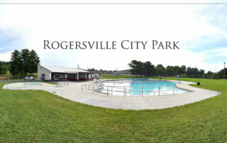
Rogersville City Park
Rogersville City Park311 Park Boulevard Rogersville, TN 37857Phone: 423-272-7497 Fax: 423-272- [...]
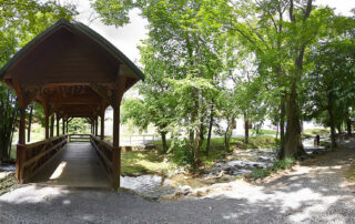
Surgoinsville Creek Side Park (Covered Bridge)
Beautiful creek park with unique covered bridge walk - located in the city center of Surgoinsv [...]
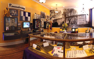
Swift Museum & Price Public School
Swift Memorial Junior College and Swift College was founded in 1883 by the Rev. Dr. William He [...]
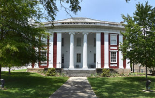
Overton Masonic Lodge #5
Founded December 14, 1805, Overton Lodge was, at the time of its formation, a part of the Gran [...]
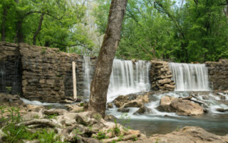
Amis Mill Eatery / Thomas Amis House
Amis Mill Eatery:Join us at the Historic Amis Grounds for Events, Great Food, Weddings, Tours [...]
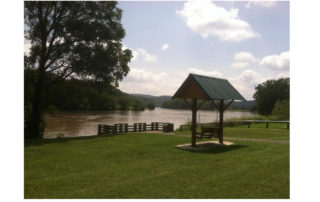
Surgoinsville River Front Park
Surgoinsville River Front Park in the heart of the town runs along the Holston River. The Park [...]